San Diego Land-Use Model Assessment
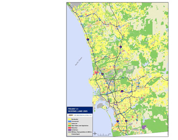
RSG is leading an effort to assess the performance of the current SANDAG Production, Exchange and Consumptions Allocation System (PECAS) land-use model implementation, and make recommendations to establish improved and more direct integration between PECAS and the SANDAG CT-RAMP activity-based travel demand model (ABM). The recommendations address both conceptual and practical considerations associated with the…
Model Integration
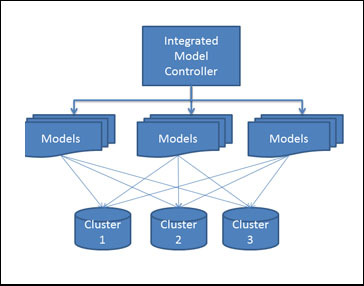
SANDAG has developed an extensive suite of analytic tools, including regional economic and demographic forecasting models, a land-use model, an activity-based travel demand model, and numerous other supporting tools and databases. These individual models and tools exchange information and collectively comprise the regional long-term forecasting model system, although each model component was executed individually, and…
Regional Plan Evaluation Criteria and Performance Measures
Over the past few years, SANDAG has been developing new analytic tools and capabilities. Two of the most significant additions to SANDAG’s analysis tool kit include the development and implementation of a CT-RAMP activity-based model system and the development and implementation of a PECAS land-use model. In order to help staff make maximal use of…
Active Transportation Model Enhancements
RSG is leading a team making active transportation related enhancements to SANDAG’s activity-based model system. These enhancements include the development of a bicycle route choice model and improved pedestrian pathbuilding capabilities that use the regional “all streets” network and are sensitive to detailed network and demographic attributes. The project team built and populated a regional…
Regional Household Travel Survey
As one of the fastest growing areas of Washington (located about 60 miles south of Seattle), the Thurston region has experienced significant growth. In order to provide data to update, refine, and enhance the travel assumptions in the Thurston Regional Planning Council’s travel demand model, RSG is conducting a Household Travel Survey (HTS) for the…
Quantitative Approaches for Project Prioritization: A Puget Sound Case Study
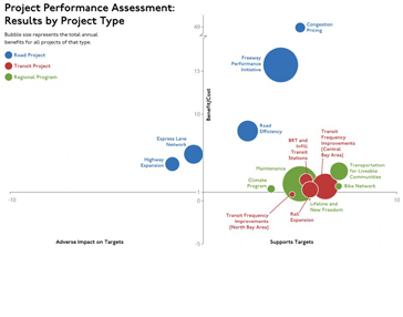
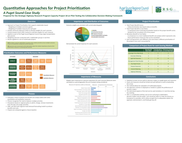
Transportation projects in major metropolitan regions can vary widely in the types of benefits they provide and in the scales of those benefits. Travel forecasting models and related procedures can provide reasonable estimates of those benefits and many of the benefits can be distilled into equivalent dollar benefits using consumer surplus or other valuation approaches….
HELPViz: Integrated CommunityViz – Land-use Model
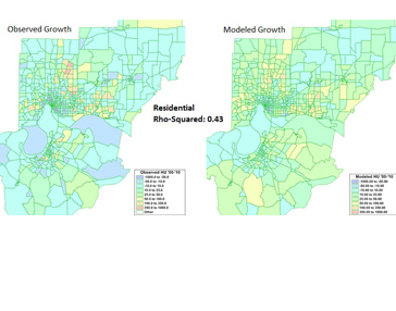
RSG designed and implemented a new, two-level approach to land-use forecasting that integrates econometric land-use modeling techniques—implemented in TransCAD—with CommunityViz’s GIS/3D visualization functionality and parcel-level detail. The Evansville region has experienced moderate, steady growth in recent decades but struggled with increasing vacancy in some areas as new development outpaced overall growth. A new regional plan…
Tour-based and Supply Chain Modeling for Freight
Despite recent advances in freight and commercial vehicle modeling, the current state of the practice methods are not adequate to address the increasingly complex issues related to freight demand. This project includes research that has combined tour-based truck models and logistics supply chain models for urban commercial vehicle movements, and that has demonstrated a functional…
Model Improvement Program – Freight Forecasting
RSG developed valley-wide and county-level goods movement model improvements for the eight San Joaquin Valley county agencies as part of the San Joaquin Valley Model Improvement Program (MIP). The goods movement modeling improvements included updating commodity flow data, updating economic flow data, updating agriculture flow data, and revising the methods used for short-haul commercial vehicles…
South Bend Indiana Model Update
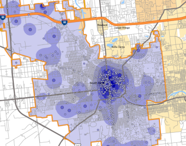
The Michiana Area Council of Governments (MACOG) hired RSG to develop an integrated travel model system that combines elements of advanced activity-based travel demand models with a traditional trip-based model, creating a hybrid travel demand model. This work included building and estimating the following components into the existing TransCAD model structure: A population synthesizer A…
Interstate-81 Corridor Study
Segments of Interstate I-81 in Syracuse, New York, are nearing the end of their structural lifespan; particularly the most heavily traveled elevated sections through the downtown, which is known as The Viaduct. In the coming years, significant portions of the roadway will need to be replaced, reconstructed, removed, or otherwise changed at a significant cost….
Colchester-Essex Network Transportation Study
In 2012, it was announced that the Circumferential (Circ) Highway would not be constructed as originally conceived to provide a limited access highway from I-89 in Williston to I-89 in Colchester. The Chittenden County Regional Planning Commission (CCRPC)—in coordination with the Towns of Colchester and Essex—initiated the Colchester-Essex Network Transportation Study (CENTS) to understand how…

