Aircraft Noise Modeling and Visitor Soundscape Experience Survey
The National Parks Air Tour Management Act of 2000 requires the development of Commercial Air Tour Management Plans (ATMP’s) for national parks. A primary purpose of ATMPs is to manage potential impacts of air tour operations on park resources and visitors’ experiences, including aircraft noise impacts. The National Parks Air Tour Management Act of 2000…
Integrated Transportation and Capacity Assessment
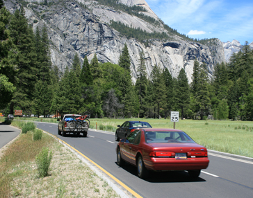
Yosemite National Park ranks among the most heavily visited national parks in the United States, accommodating approximately four million visitors annually. Much of the park’s visitor use is concentrated in Yosemite Valley; the valley comprises merely four percent of the park’s total area, yet accommodates 98% of all park visitation. Furthermore, one-third of all park…
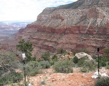
Modeling Hiker Exposure to Natural Sounds and Quiet in the Tuolumne River Watershed
Tioga Road is a National Scenic Byway that passes through the Tuolumne River Wild and Scenic River watershed in the heart of Yosemite National Park’s high country. The road provides access to trailheads, a campground, and other high country destinations in the park. Moreover, Tioga Road provides outstanding opportunities for scenic driving, which is among…
Integrated Transit Service Planning and Visitor Use Management
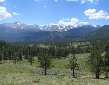
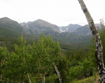
Rocky Mountain National Park (RMNP) was one of the first national parks to adopt an alternative transportation system, initiating a shuttle bus system in 1978. To address parking lot shortages in the popular Bear Lake Road Corridor, while accommodating growing numbers of visitors, RMNP expanded their shuttle service in 2001. While the expanded shuttle service…
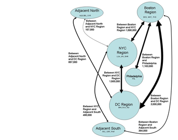
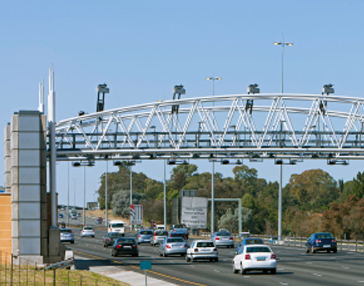
Innovative Approaches to Addressing Aviation Capacity in Coastal Mega-regions
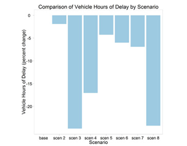
RSG served as the prime contractor for a major study of potential solutions to airport and airspace capacity issues in the highly congested US east and west coast mega-regions. The wide-ranging project scope included a detailed assessment of several strategies for reducing delays at the major airports in these regions. The project report describes issues…
Modeling Hiker Exposure to Transportation Noise
The Bear Lake corridor in Rocky Mountain National Park is one of the most heavily used areas of the park. It is attractive both for easy accessibility to Bear Lake, and for its many trailheads leading to backcountry locations. As a result, the corridor supports a relatively high volume of vehicle traffic, which can adversely…
Half Dome Cables Visitor Use Measurement and Modeling
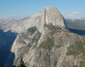
The hike to the summit of Half Dome is among the most iconic and popular backcountry excursions for visitors to Yosemite National Park. The culmination of the hike involves ascending the last 400 feet of Half Dome via a cable system. Recent accidents involving fatal falls from the granite dome caused concern about safety on…
Intelligent Transportation Systems Planning and Deployment
Mount Rainier National Park (MORA) accommodates more than one million visitors annually, and experiences intensive visitation during summer months. During peak periods of visitation, visitors must wait in long lines of traffic to enter the park and have difficulty finding places to park their cars once they enter the park. The park’s General Management Plan…
The Effect of Smart Growth Policies on Travel Demand
The Smart Growth Area Planning (SmartGAP) tool was developed as part of the of the SHRP 2 C16 project, “The Effect of Smart Growth Policies on Travel Demand” to provide transportation planning agencies with improved tools and methods for more accurately and comprehensively integrating transportation investment decision-making with land development and growth management (smart growth…
Travel Model Improvement Program (TMIP) Program Support and Outreach
The Travel Model Improvement Program (TMIP) is a program within the FHWA Office of Planning that conducts research, provides technical assistance, and delivers training to local, regional, and state transportation planning professionals. TMIP works to advance travel modeling capabilities and support transportation professionals as they respond to current and future challenges. TMIP is guided by…
NEPA (National Environmental Protection Act) Travel Forecasting Guidance
A successful National Environmental Policy Act (NEPA) process requires defensible land-use and travel forecasts to supply information for purpose and need, alternatives analysis, and environmental impacts. While technical guidelines for producing forecasts for projects had been documented by others, guidance had not been provided on the procedural or process considerations in forecasting. Acknowledging this, the…
Integrated Activity-based Model with a Time-sensitive Network
RSG developed an integrated travel model system that combines an advanced activity-based travel demand model with a detailed time-sensitive network assignment model. This model system more accurately captures the dynamic interplay between traveler behavior and network conditions, and allows planning organizations to build more accurate models. These models will enhance the decision making process around…
- « Previous
- 1
- 2
- 3
- Next »