Anchorage Metropolitan Area Transportation Solutions (AMATS) is the metropolitan planning organization for Anchorage, the largest city in Alaska. In 2013, the organization worked with RSG to develop a travel modeling system to understand patterns and behaviors across the region. Several years later, AMATS was still using its 2013 base-year inputs despite significant changes in the methods and routes people use to travel. In 2021 and 2022, AMATS updated its input data and modeling system to reflect a more current base year that would allow them to generate more accurate forecasts for their 2050 Metropolitan Transportation Plan.
The Challenge
In the context of the transformation of travel patterns in the region, AMATS’ nearly decade-old 2013 base-year inputs meant the reliability of forecasts produced by their model had diminished. RSG had previously worked with AMATS to conduct their household travel survey, which provided the base-year inputs for their current model. Significant transit route changes since the prior survey (due to an updated route restructuring plan that Anchorage’s Public Transportation Department led) meant that previously collected origin-destination data was not as relevant this time around. Instead, RSG proposed using traffic counts obtained by the Alaska Department of Transportation (ADOT), passively collected location-based services (LBS) data, and transit boarding data collected by People Mover, Anchorage’s public transit provider, to help calibrate the updated model.
Given these changes, AMATS knew that updating the travel model base year to data from 2019 would require the following:
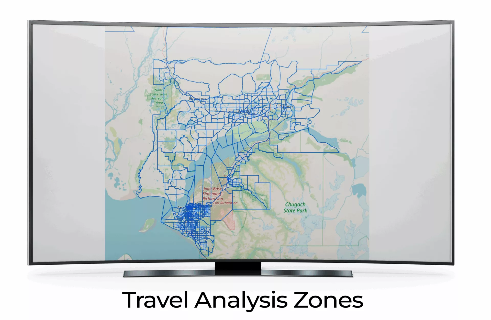
- Refining the travel analysis zone (TAZ) boundaries to represent best practice zonal delineation.
- Updating TAZ data inputs, including North American Industry Classification System (NAICS)-based employment categories.
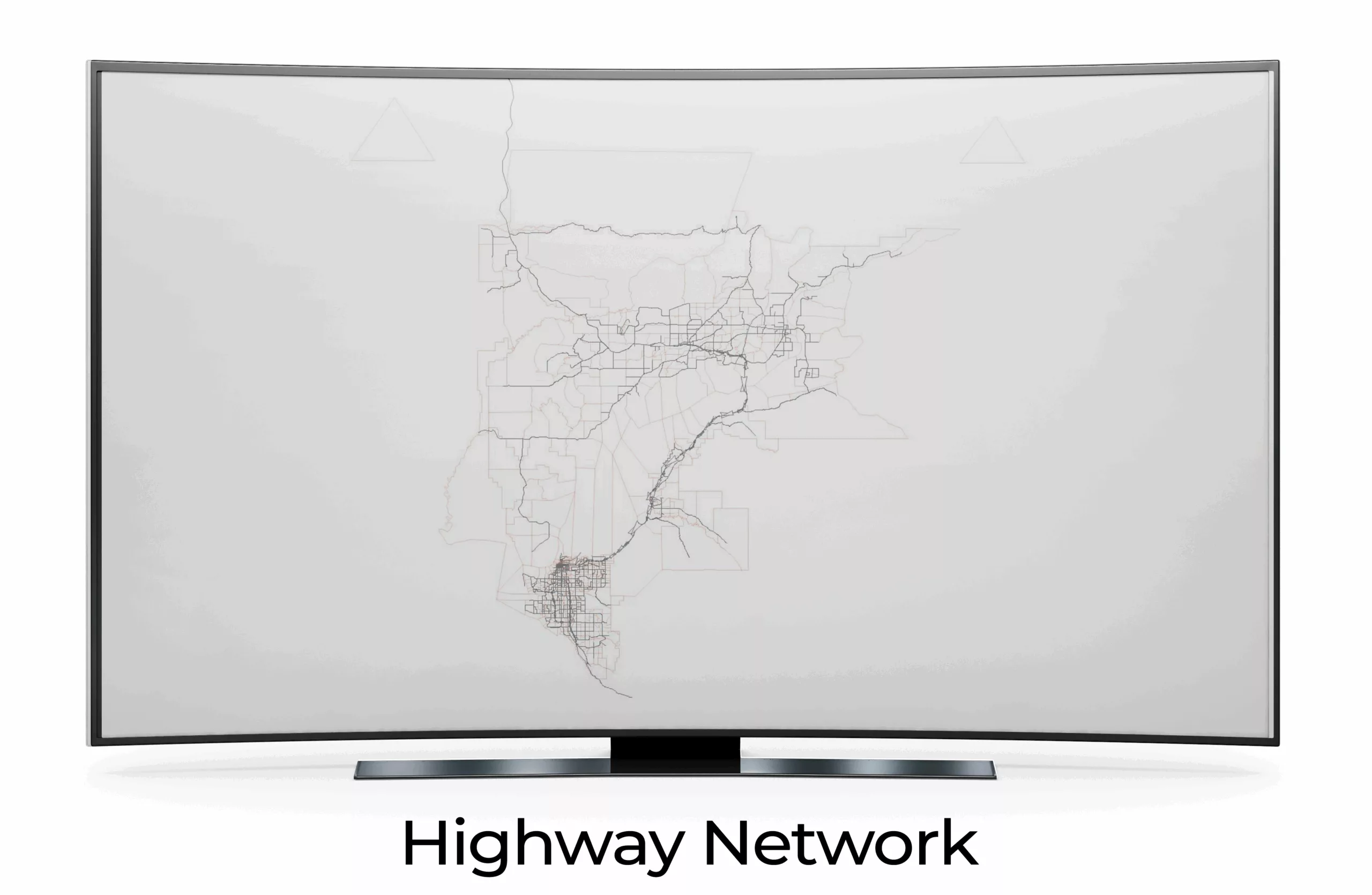
- Updating the network line detail to account for prepandemic travel conditions.
- Updating network data inputs, including changes to control type, lanes, speed, and general intersection geometry.
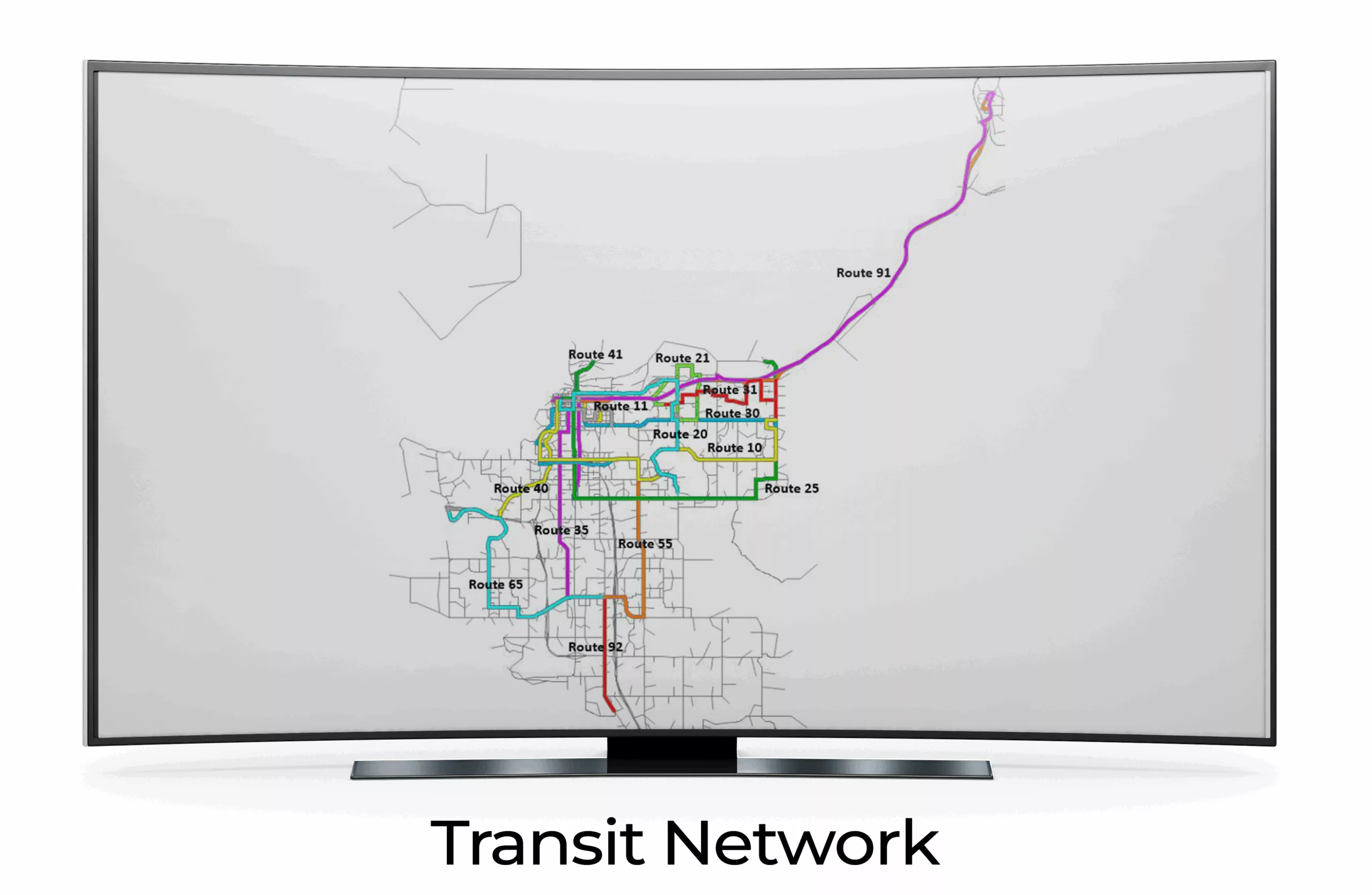
- Updating transit routes to reflect 2019 transit network conditions.
- Updating the mode choice model to reflect sensitivity to “4D” walkability variables.
- Identifying functional intersection influence areas around controlled intersections to assist in assessing the impacts of intersection control treatments.
- Create materials to help state DOT audiences understand how different conditions impact roadway noise levels.
RSG’s Solution
To accomplish these objectives, RSG, in partnership with R&M Consultants, Inc., leveraged our team’s significant travel model development expertise and prior knowledge of the region through our household travel survey work. Rather than undertaking the project in a single phase, we split the AMATS travel model update into three phases to improve outcomes by allowing for adjustments in strategy as the project progressed.
1. Updating Inputs
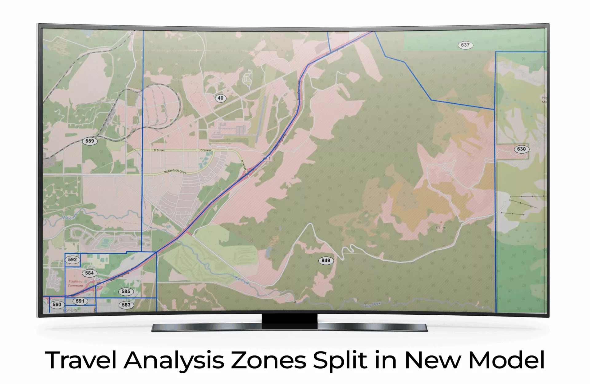
First, our team made a single-yet-significant change to the travel analysis zones by splitting a previously large single zone into two zones. This was done to split the intense military activity of Joint Base Elmendorf-Richardson (JBER) to the north from the recreational areas in the south. In addition, we included increased intersection resolution by identifying the upstream functional intersection areas to the highway network. We also created a detailed transit network, using route frequency data from the People Mover system.
2. Changing Model Specifications
As part of these AMATS model updates, RSG also introduced new enhancements to its specifications. For instance, we updated the population, employment data, and trip rates for military zones and calibrated them using gate counts. We also updated mode choice to include a 4D analysis that considers the impacts of accessibility through the lens of: 1) Diversity of land uses; 2) High Density; 3) Transit and alternative-oriented Design; and 4) Access to Destinations by alternative means.
3. Calibrating and Validating the Model
Finally, we meticulously calibrated and validated the updated AMATS travel model to ensure its precision and reliability. With small adjustments to factors such as trip generation, mode choice, and signal timing, we successfully validated the model’s performance against real-world data to ensure that it met industry standards. By leveraging this updated travel model with a base year of 2019, AMATS will be able to develop more accurate forecasts to assist in the organization’s future transportation planning initiatives.
Our collaboration with AMATS in refining their travel demand model played a pivotal role in the formulation of their 2050 metropolitan transportation plan. These enhancements not only facilitated a more precise evaluation of proposed improvements but also empowered AMATS to address critical planning considerations. Among the most vital was understanding how mode choice advancements influenced the agency’s examination of the effects of compact versus sprawl development within the metropolitan planning framework.
Download a PDF