National parks like Mount Rainier National Park, located in Washington State, attract millions of visitors each year. Congestion from visitation can negatively affect the natural and cultural resources of parks and gateway communities, as well as visitor experiences. Through public lands planning processes, the National Park Service (NPS) seeks to preserve its dual mandate of preserving park resources in parks like Mount Rainier National Park while facilitating public enjoyment of these areas.
The Challenge
Visitation to Mount Rainier National Park has continued to increase over the last decade. To better understand the impacts related to increased visitation and develop strategies in response, NPS commissioned the Mount Rainier National Park Regional Transportation Analysis Project (RTAP).
For the RTAP, NPS sought to deploy an innovative solution that incorporated passive mobility data analytics into the public lands planning process. Using location-based services (LBS) data to analyze, assess, and understand visitor travel patterns would also permit NPS to evaluate the suitability of LBS inferences in future NPS strategies. Because LBS is an evolving technology and data collection method, NPS wanted to see if it could be used to:
- Confirm or update current assumptions around visitor travel to and from Mount Rainier National Park.
- Understand visitor travel patterns to and through the park.
- Identify correlations between visitor travel patterns and other driving factors.
- Develop preliminary insights for strategies that reduce the impact of increased visitors.
NPS chose RSG to evaluate the feasibility of using LBS data because of our significant public lands planning and mobility data analytics expertise.
RSG's Solution
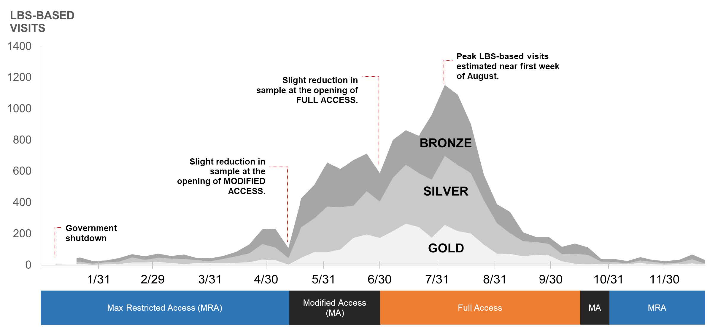
To accomplish its goals for the project, NPS divided the RTAP into two phases. Phase I leveraged LBS data and evaluated its efficacy in active planning efforts; NPS also wanted to use this first phase to determine potential applications in other areas of visitor management and park planning. Phase II built on the results of this initial stage, processing both LBS and Wi-Fi data to examine in-park trip characteristics and estimate patterns of travel and durations of stay.
The project team achieved the key goals established at the project’s outset. Our team concluded the LBS data provided credible information and insights into visitation trends and patterns, identifying where people were coming from, the routes they traveled, and the gateways they traveled through. This is particularly important as the team also determined Wi-Fi-based data collection (another method used to understand similar research questions) to no longer be reliable since this data required extensive postprocessing and generated biased estimates.
As a result of this work, NPS received valuable insights that it can use to improve traffic management and conditions for both park visitors and the surrounding communities. Overall, RSG helped NPS gain a better understanding of where visitors are coming from and where they travel in and around the park. RSG’s insights have provided valuable information that NPS will use to develop optimized strategies and plans to provide quality and sustainable access to the park for visitors.


Download PDF
Can we stay connected?
Sign up for RSG emails to keep up with our news & insights.

