To expand mobility options and improve accessibility to the Norfolk International Airport (ORF), major activity centers along Military Highway, and to Naval Station Norfolk, Hampton Roads Transit (HRT) assessed several high-capacity transit service alignment alternatives on the east side of the City of Norfolk, Virginia. These included adding an adjacent stop or direct connection to ORF to serve airport travelers and employees. These alternatives would help meet the region’s needs for a cost-effective, fast, flood-resistant, and sustainable alternative to personal vehicles and ride-hailing services.
The Challenge
The City of Norfolk was faced with a situation in which no public transportation options served ORF from the surrounding communities. While workers could use HRT services to shuttle between an off-site employee lot and the terminal building, air travelers without access to a vehicle had been restricted to using taxis or other ride-hailing or carsharing services. In addition to accessibility issues, the region had faced congestion due to the high volume of personal and commercial vehicles traveling to and from the airport.
HRT’s Naval Station Norfolk Transit Corridor Project focused on evaluating two alternative technologies: light-rail transit (LRT) and bus rapid transit (BRT). To help evaluate the feasibility of a high-capacity transit service, HRT and Michael Baker-STV Transit JV chose RSG to survey regional travelers and forecast potential ridership on the proposed fixed guideway routes. Our team was chosen because of our significant survey-based research and transportation forecasting expertise.
RSG's Solution
The goals of the Naval Station Norfolk Transit Corridor Project were twofold: 1) Determine the likelihood that airport travelers and employees would use LRT and BRT services; and 2) develop a regional transit model to forecast potential ridership for each alignment alternative.
The project was divided into two phases:
- Airport Ground Access Mode Choice Survey: This airport intercept survey gathered stated preference (SP) data by asking passengers and employees if they would use a new LRT or BRT service to arrive at ORF.
- STOPS LRT and BRT Ridership Forecasts: The Federal Transit Administration’s Simplified Trips-on-Project Software (STOPS) is a modeling application that uses survey and other types of data to forecast stop- and route-level ridership. STOPS was used to model the proposed LRT and BRT service alternatives.
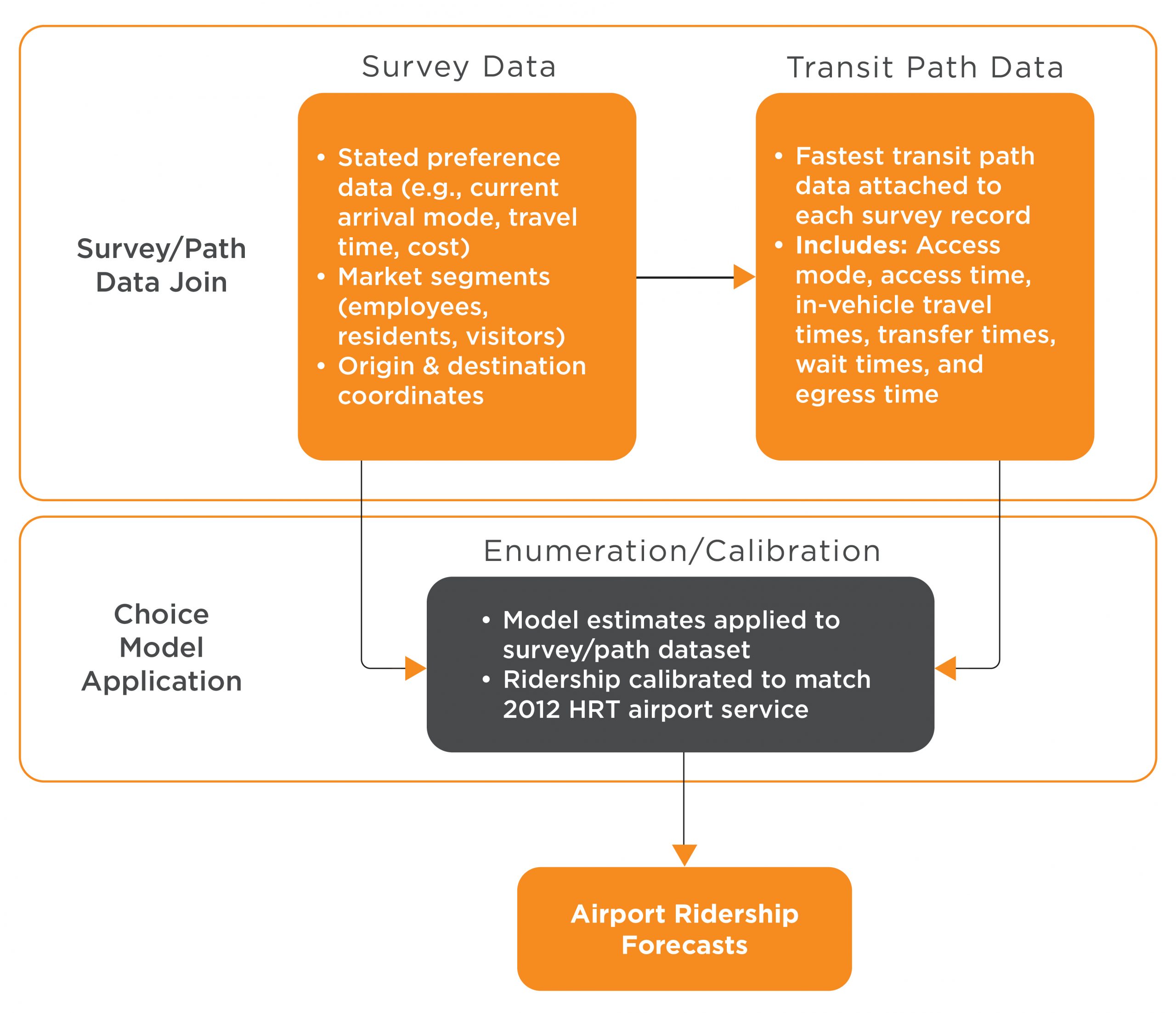
Because the airport is considered a “special market” that is not currently served by public transit, ridership forecasts cannot be rendered using STOPS. Therefore, it was necessary to collect passenger and employee survey data to inform a separate ridership model for passengers arriving or departing ORF using surface transportation modes.
RSG successfully developed and conducted the SP survey, gathering 896 valid responses from ORF travelers and employees while informing them about the proposed high-capacity transit services. The results revealed an overall positive reception to the proposed LRT and BRT services, especially among respondents who commuted.
RSG used the SP data to develop discrete choice models, which were applied in a purpose-built simulation tool to derive airport-specific ridership for the proposed alternatives.
RSG next developed a regional transit model using STOPS to produce LRT and BRT service alternative forecasts. The results of the employee and air passenger simulations were included along with the STOPS daily ridership estimates to create a complete picture of current and horizon year linked and unliked trips under various alternatives. Based on prepandemic data from 2019, the forecasts showed that LRT alternatives could garner approximately 6,000 to 10,300 daily riders, while BRT alternatives would generate substantially lower ridership (around 2,200 to 3,250 daily riders). Half of the project’s ridership was forecast to be new riders in the system.


Download PDF
Can we stay connected?
Sign up for RSG emails to keep up with our news & insights.

