Corridor Management Plan for Mount Rainier National Park
National Park Service (NPS)
A Pacific Northwest icon, Mount Rainier National Park (MORA) is popular, attracting millions of visitors. However, its popularity has degraded park resources and increased traffic in and through gateway communities. This, in turn, has hurt visitors’ experiences during peak periods. As a result, the National Park Service (NPS) sought to develop a corridor management plan for MORA. The corridor management plan was innovative in that it called for both old and new data collection methods, including passively collected location-based services (LBS) data (“big data”).
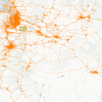
To assist NPS, we collected available visitation data for MORA. This entailed finding all relevant existing NPS data sources for travel to and within MORA. Then, we developed a custom data collection and analysis plan for the project that included using LBS data to confirm or update NPS assumptions about visitor travel to and through MORA and understand visitor travel patterns and correlations between these and other visitation factors. RSG used big data insights to process the LBS data for the study area. A project-specific big data processing workflow and device-quality filtering algorithm classified devices as bronze, silver, and gold. We then checked NPS assumptions against our big data findings by comparing these to existing park data sources.
RSG used its findings to deliver custom data insights for the project area. These insights, organized by topic area, covered visitors’ home locations and travel patterns en route to and in the park. NPS used our findings to inform strategy. This, in turn, will help improve park visitor experiences, visitor access, and operational efficiencies along travel routes. Most importantly, this project validated the suitability of using big data for other NPS planning and management applications, serving as a proof-of-concept study for big data analyses to support regional planning or corridor-level efforts.


