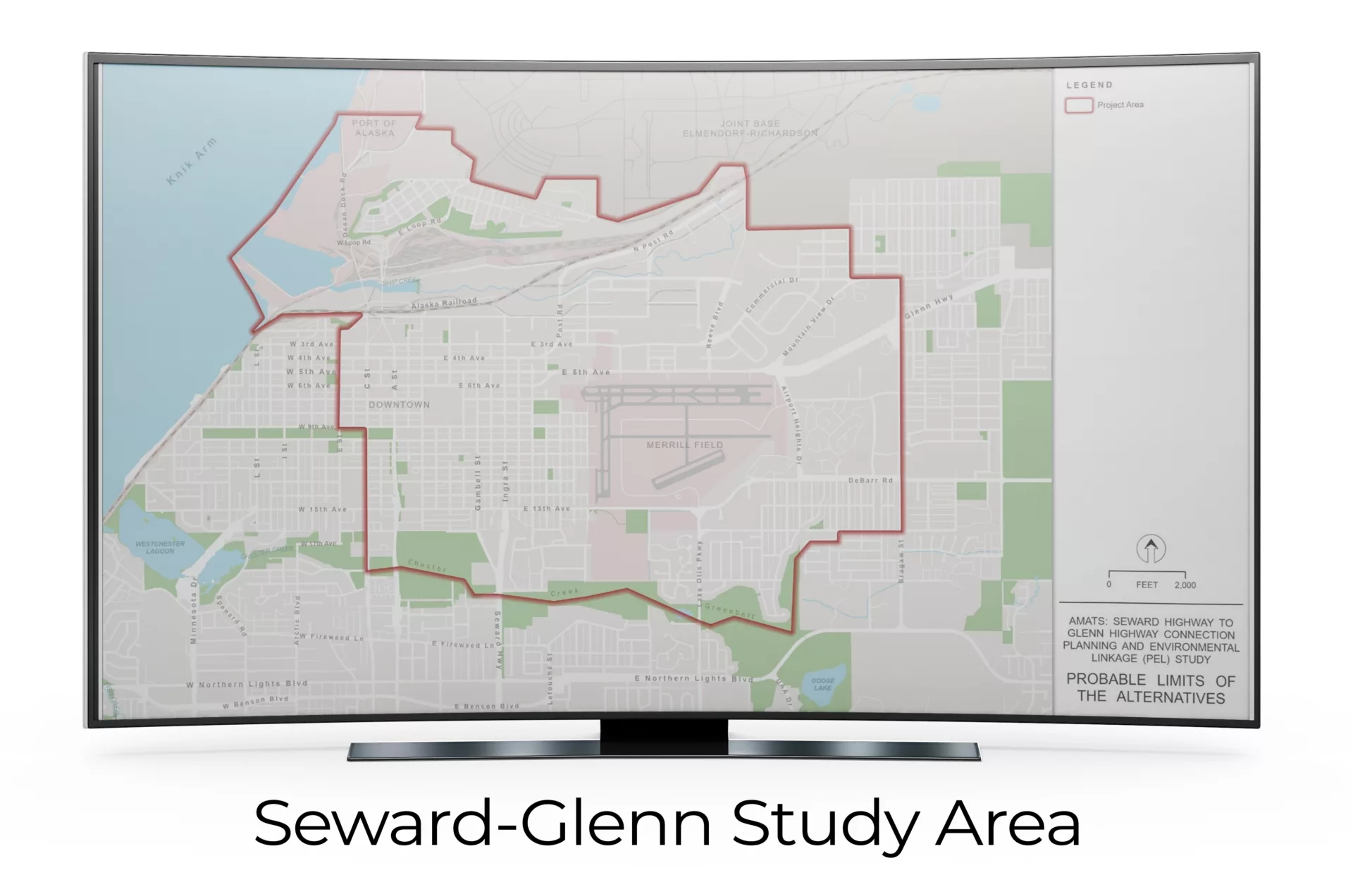
Anchorage is the largest city in Alaska, with a population of over 288,000 people. However, like many places in Alaska, it is fairly isolated; only three highways enter and exit the region. Furthermore, two of these highways (Seward and Glenn) turn into a “couplet,” or pair of one-way surface streets, that carry high volumes of traffic directly through the downtown area. This design configuration has raised concerns in the community around access and safety. Meanwhile, the Alaska Department of Transportation and Public Facilities (ADOT&PF) has contemplated whether the current configuration can support future needs.
The Challenge
Anchorage’s isolation, the vital nature of its few highway links, and the use of surface streets for through traffic create a challenging downtown situation for planners. While the city does not currently have major congestion issues, ADOT&PF officials need to know whether the system can handle future traffic projections and do so safely in the context of the surrounding community.
In response, ADOT&PF launched the Seward Highway to Glenn Highway Connection Planning & Environmental Linkage Study (SG PEL). The purpose of this study is to tie planning-level analysis and future traffic forecasts into anticipated environmental review requirements. Because of our team’s past work developing the travel demand model with a 2013 base year for the Anchorage Metropolitan Area Transportation Solutions (AMATS), which used 2013 as a base year, ADOT&PF selected a team that included RSG to apply our travel model development expertise to update the model and use it to help answer the planning questions.
RSG’s Solution
To help ADOT&PF identify options to improve travel and connectivity between the Seward and Glenn Highways, RSG enhanced the previous AMATS travel demand model in several ways. First, our team updated the model with 2019 as the base year using new socioeconomic, land-use, and network data for the region. This allowed us to calibrate and validate a model customized for the SG PEL study to match observed performance and ensure forecast accuracy. Moreover, we chose 2019 as a base year because it gave us the opportunity to identify existing conditions and system deficiencies before the pandemic impacted demand for travel.
RSG also applied our passive mobility data analytics expertise by using location-based services (LBS) data to conduct an origin-destination (OD) study. This OD study delivered a rich data sample of travel in and around the project area. Using traffic counts of the studied system, US Census Bureau data, and passively collected data, our team performed a detailed analysis of the locations where travelers come from and go to. This was used both to inform the SG PEL travel model development and provide overarching insights into travel patterns for ADOT&PF and the public.
Combining the results of the OD study with the updated SG PEL model, RSG developed 2019 findings and future 2050 horizon year projections. Together, these data illuminate “existing conditions” and show the probable future conditions absent changes to the system.
RSG’s projections of future system performance identified specific factors that planners can use in suggesting alternative configurations for further study. For example, travelers’ flow patterns tend to follow certain directions given the layout of the local streets and neighborhoods, and the highways entering the surface street system may themselves become bottlenecks. These are valuable insights the ADOT&PF can use to design and plan for future improvements to the Seward-Glenn connection.
Download a PDF


